*Kashmir upper reaches receive snowfall, rains lash plains*
*MeT predicts erratic weather till March 16* *Peak activity expected between March 13 to 15* *Farmers asked to suspend work for next 6 days*
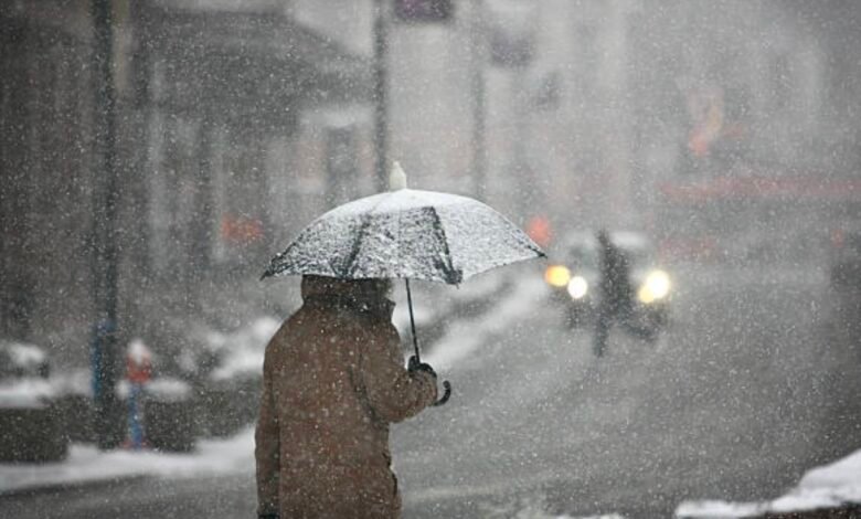
*Kashmir upper reaches receive snowfall, rains lash plains*
Srinagar, Mar 10 : Even as Kashmir upper reaches received fresh snowfall and rains lashed plains on Monday, the Meteorological department (MeT) predicted erratic weather conditions for the next six days, forecasting intermittent rain and snowfall till March 16.
According to the news agency—, several areas including Sadhna Top, Machil , Keran sector, Gulmarg, Gurez Valley, Razdan Top, Zojila Pass, Sonamarg and other higher reaches received fresh snowfall.
Rains lashed the plains including Srinagar, the summer capital of Jammu and Kashmir, which led to the temperatures plummeting across the Valley.
Meanwhile, Director MeT, Dr Mukhtar Ahmad while talking to KNO said, “Intermittent spell of light to moderate rain and snow is expected at many places from March 12 to 14.”
Moreover, he said that the weather conditions are expected to remain dry from March 17 to March 21.
“Peak activity or most rain and snow is expected on March 13, 14 & 15. Few higher reaches may receive heavy snowfall as well,” said an independent weather forecaster, as per KNO.
In its advisory, the MeT has advised travellers, tourists and transporters to follow administration and traffic advisory while farmers have been asked to suspend farm operations from 10th March onwards till 16th March. “Avoid sloppy & avalanche prone areas,” the advisory reads—